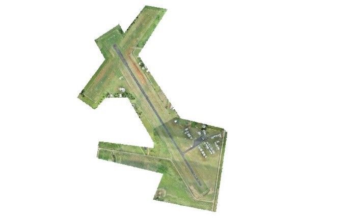
Kybong Aerodrome Detail Survey
Kybong, Queensland
Project Scope: Multimodal spatial data capture and airside surveying to support Gympie Regional Council’s safety and infrastructure planning at Kybong Aerodrome
Client: Gympie Regional Council
Project Duration: 2026
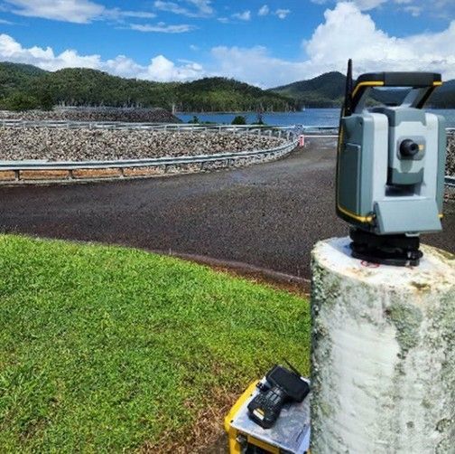
In early 2026, Murray & Associates delivered detailed ground and airside spatial data capture for Gympie Regional Council at Kybong Aerodrome. The project required precise surveying across an active aviation environment, supporting Council’s planning for future safety and infrastructure upgrades at the facility.
To achieve the required accuracy and coverage, our team combined total stations, GNSS equipment, drone‑based photogrammetry and terrestrial laser scanning. Murray & Associates operates with licensed Remote Pilot Licence (RePL) holders and certified drone operators, enabling the safe deployment of advanced aerial mapping technologies to capture high‑resolution spatial data. Our surveyors also bring proven experience in aviation settings, having previously completed similar survey works at Emerald Airport. The resulting dataset provides Council with a robust spatial foundation to inform upcoming design, compliance and safety improvement initiatives at the aerodrome.